
Trip Overview:
Canaan VT to Stratford Hollow
May 26, 2017 – May 29, 2017
2 days on the water
36.5 miles paddled.
With the long Memorial Day Weekend and spring’s high water levels, we hoped to cover a good stretch of the northern part of the river. All of our trips to date have included camping, but this will be the first time we’re carrying our camping gear in the kayaks. The plan will be to spend two nights camping along the river. Several campsites are spread out such that we’ll have one long day of paddling and one shorter day. With our camping gear in kayak, we’ll have the flexibility to decide which day is which as we go.
Chuck and I met up in Lancaster to scout the river on our way up to Canaan. We drove along route 102 on the Vermont side which has good views of the river. The water levels were good the whole way up. We staged one car at the bridge between Maidstone and Stratford Hollow. We’d come to regret this a bit, but more on that later. We stopped in Bloomfield to check out some rapids mentioned in the CT river guide; they seemed to be relatively manageable. We switched over to the NH side of the river to checkout the Lyman Falls. There is car access to scout the falls from route 3 by means of a dirt road. This has large holes and steep sections, so having a car with a little extra clearance and AWD is helpful. Lyman Falls has a large rocky beach which provides a good campsite option. The beach is a few feet above the water level. There are also a couple of wooded sites several feet higher. From the beach you can get a good view of the breached dam. The gap to avoid the dam debris is very small, so it worth scouting this out ahead of time. When paddling the falls you want to be within a couple of yards of the NH bank. Another yard from shore and you’ll hit the dam which is just below the water level.

From Lyman we went straight up to Canaan and we spent Friday night at Maurice’s Motel. It was a great choice. The owner was very accommodating, and the Northland Restaurant is just across the street. In the morning, we had a short 100 foot drive down the road to the put in next to the Main Street overpass. We then loaded up the kayaks with all our gear and supplies for the next two days. When I could barely drag my kayak over to the launch ramp, I became a bit concerned. It had become extremely heavy from the gear. I could imagine it instantly sinking once I sat in it. We estimated the weight again which was well within the kayak’s limit, but this still wasn’t enough to convince me to get in the kayak. So I unloaded some of the larger items and placed them on the ramp at the water’s edge. I got into the kayak, and one by one placed items back in the kayak. Lo and behold, it didn’t sink! With my confidence in both my kayak manufacturer’s specs and our estimating abilities restored, we headed out on the river.


This top section of the river is very placid as the river meanders along the area’s farms.

We took our first break in Colebrook as we found a nice cobble stone island that had cell service. A pair of young eagles were using the cell tower as a perch. We stopped long enough to brew up some coffee and have a quick snack.

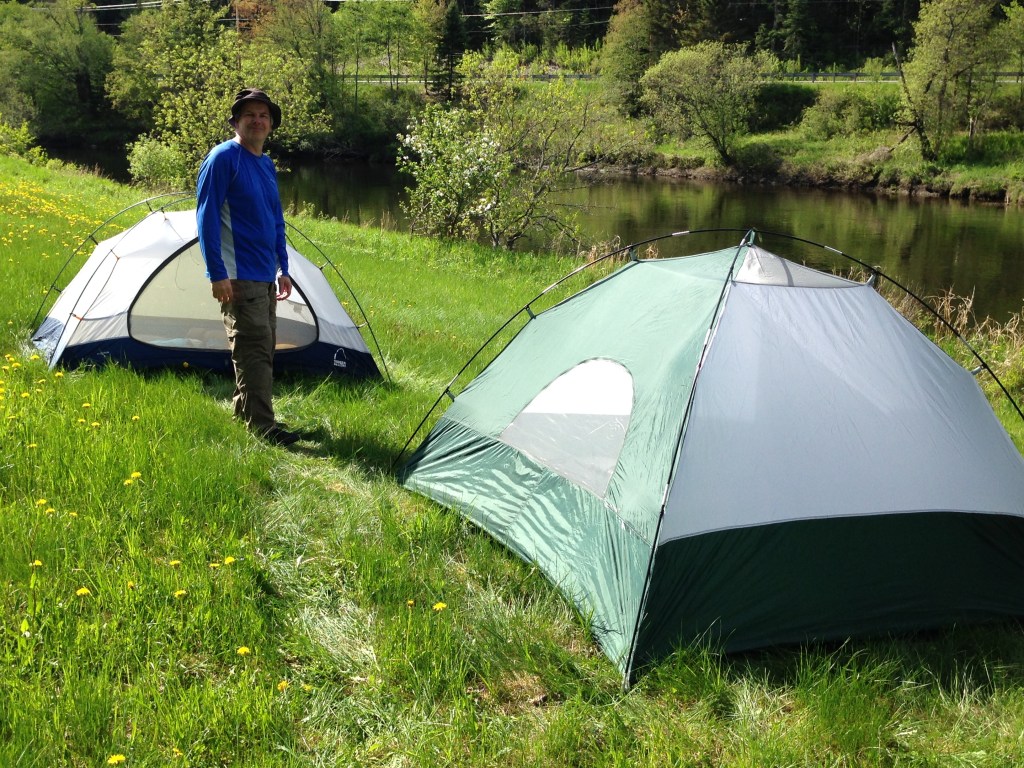
Chuck was slowly recovering from a shoulder injury for the last couple of months, so we decided to make our first day a shorter warm-up day. We came upon Holbrook Point campsite and decided to check it out. The site is up a steep 5 ft bank. There were a couple narrow paths to the site, but no easy way to get the kayaks or gear up to the site. There was also a lot of standing water around so we decided to continue down river to the next site. This was Columbia Campsite which is on the NH side of the river. There was a small sign marking the site, as there was at the previous site. A small landing area had enough space to beach and tie-off several kayaks. From the landing a path leads up a shallow incline, passing through a row of trees and opening to a large grassy field.


This being our shorter day on the water, we arrived with plenty of sunlight to set up camp. With all of the brush and grass we decided to break out the DEET. We found a couple of ticks on our gear but avoided getting them on our persons. We also sprayed DEET liberally around the base of our tents. This turned out to be very pleasant spot to camp. There is a single house across the river, and not much else around. The owner, an older gentleman, saw us land and came over to greet us from the opposite bank. Seeing all of our gear, he asked if we were headed to Long Island. We told him we were, eventually, but not on this trip. We continued talking about our trip and the river conditions. He told us that the clearing the campsite was on had once been a farm. It was long and straight abutting the river. We were at the low end where the field bent down toward the river. At one point we heard a small plane and turned to see it coming at us over the clearing after nearly touching down! Our guess is that it mistook the field for a small airport several miles away. It was cool to see, but scary stuff! After a bite to eat and setting up camp, we anchored in the river where Chuck dusted off his guitar skills and I attempted to fish.
A great advantage of camping out of the kayaks is the ability to hit the river early the next morning, no need to stage the cars. Fortunately it was a sunny morning and we were able to give the tents some time to dry out from the dew they collected overnight. The temperature had gotten down to a low of forty degrees last night. Chuck mentioned he was cold in his sleeping bag and had to put on a knit hat to try to stay warm. Seeing that the morning dew had wept through our tents quite a bit, we were very lucky it didn’t rain. The tents would not have kept out rain, and at forty degrees that would have been a life threatening problem!

Heading out on the river for the day, we targeted the RR trestle campsite as our next destination. It turned out there was a lot of quick water in this upper section of the river. We moved at a pretty good clip with little effort. This section culminates with the Lyman Falls. We landed at the head of the island just above the falls to scout out the river, stopping at a point where the river kicks out to the right into a class II rapids. We were reasonably sure we could navigate these rapids, and were we to flip we were not likely to be seriously injured. But we wanted to do our very best to keep our gear dry, so we decided to line our kayaks in the shallows to pass these rapids. Then we jumped into our kayaks to head through the breach in the dam. We knew to stay to the left but didn’t realize just how far to the left you need to stay. Though we had scouted it in advance, I was still surprised when I passed through a small six-foot gap between the river bank and the dam. Once through the gap you’re pushed directly to the shore of the Lyman campsite. We chose to stop here and have some coffee and lunch. After putting back in the river there is still some more quick water for about a half a mile.

We reached Bloomfield by 2:00 PM with some decisions to make. Chuck’s shoulder had been in moderate pain continuously, his paddling had been somewhat joyless work, and storms were forecast for the overnight. Drained, he suggested the option that we could pull out here and make our way to the car 12 miles down the road. I suggested the other two possibilities are: We could stick with the original plan, to set up camp a few miles up, or we could paddle all the way to the car. I recommended this last option as we had 8 hours of daylight and 12 miles to the cars. I figured we had enough time that we could almost float to the car before dark. These last 12 miles were through a wilderness area, so if we started we would have no new choices. After considering the possibilities, we decided to paddle to the car. Below Bloomfield we were back to mostly slow water and farm land with a handful of faster runs. So we spend the afternoon floating along the river’s faster runs, paddling lightly when the river got too slow. As the day wore on, Chuck’s shoulder wore out. I towed him during a long slow stretch, both to keep up adequate progress, and to give him some rest. That helped as he was able to more comfortably paddle the last couple of miles.


At the Maidstone – Stratford bridge pull-out, we found ourselves facing a muddy steep ramp. And by muddy I mean your foot sinks in passed your ankle when standing, and by steep I mean a 15 foot 60 degree incline. There are stairs to assist you once you make it out of the mud. With some rope the two of us hauled the kayaks out of the river one by one.
Up at the car we found the annoyance that someone stole the rear license plate. In the future we will try to avoid staging a car overnight at such an isolated put-in. But over the length of the river we may decide to again, so we plan to prep the cars in advance. For the plates we plan to replace the Philips head screws with some anti-theft bolts. Not that this makes them nonremovable, but it will hopefully deter theft at mischief level.
With both kayaks on the roof rack, we drove back to Canaan. The weight of the 2 kayaks was over the limit of Chuck’s roof rack, so we took it slow. Eventually we got cell service and called Maurice’s Motel for a room. We got back late, and the places in town were no longer seating for dinner. We got advice that Grizzlies was still seating; it was 20 minutes away. We went there to find that they closed the kitchen, but would still make sandwiches.
On Memorial Day morning, we packed up listening to the high school marching band practice for the town’s parade. Maurice’s property is adjacent to the local high school. And as always, it’s good to see a moose on the ride home.

